Why transit works in Vancouver: travel time versus driving
One of the things that makes transit relatively successful in Vancouver is simply raw competitive travel time.
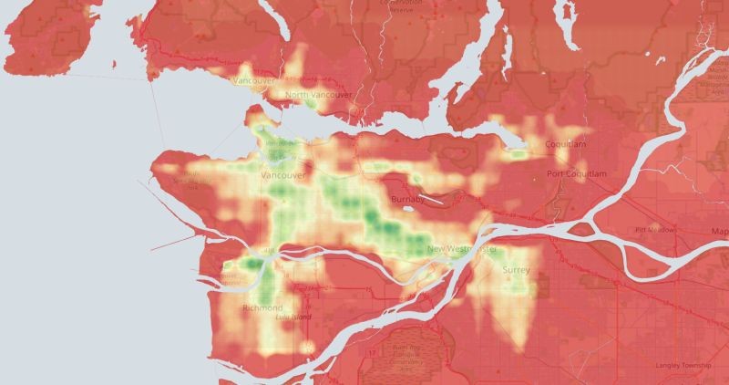
Here I’ve compiled a map showing the relative difference between transit travel time and drive time across the region to Downtown (Georgia & Granville), with darkest green representing areas where transit is better or even with driving and red areas where transit is approximately half an hour or worse than driving.
Looking this over you can really get a sense of why the Expo Line and the Canada Line have been so much more successful than the Millennium Line, despite extensive TOD. The Millennium Line has a less competitive transit offering for the biggest concentration of regional employment.
Of course the City Centre is not the be-all and end-all of transit demand or regional labour markets, but it is a handy proxy for the biggest single transit use case.
Travel time data is drawn from Google Maps API and compiled in QGIS.